What to Check When Your Project Team Receives Aerial Mapping Deliverables
When a project team receives processed aerial data, the difference between a smooth workflow and a stalled one often comes down to what the team checks first. Aerial mapping deliverables are not a single file or a simple zip folder; they are a collection of point clouds, orthophotos, digital surface models, contour lines and inspection annotations, each with its own format and coordinate system. Knowing what to verify before distributing data to engineers, surveyors or planners saves time and prevents rework later.
Coordinate system and projection
The most common mismatch in aerial mapping projects is the coordinate system. The drone mapping platform used for processing may output data in a default geographic coordinate system such as WGS84, while your local project requires state plane or a national grid. Check that every deliverable layer uses the same coordinate system and that the vertical datum matches the project's requirements. If the orthophoto uses one projection and the point cloud uses another, features will not align when overlaid. Ask the provider to confirm the datum before you start any measurement or comparison work.
Ground control and accuracy validation
Even the best processing pipeline produces errors if the ground control points are not checked. Request a report that shows the root mean square error for each check point. A responsible provider will supply this information automatically. If the report is not included, the deliverables may look correct but contain systematic shifts. For linear infrastructure projects, a shift of a few centimeters can affect cut-and-fill calculations or asset location records. The project team should also verify that at least one ground control point was measured with a known survey-grade instrument; otherwise the accuracy claims are unverifiable.
A good rule is to overlay the orthophoto on existing base mapping and measure the offset at three or four well-defined features such as manhole covers or building corners. If the offset is consistent, the data may still be usable after a shift correction. If the offset varies across the site, the processing likely has a distortion that cannot be fixed by a simple translation.
File formats and compatibility
Different team members use different software. Surveyors may work with .las or .laz point clouds, while planners prefer GeoTIFF orthophotos and CAD teams need .dxf or .dwg contour lines. Check that each deliverable is delivered in a format that your standard tools can read. Some drone mapping platforms export data in proprietary formats that require additional plugins or conversion steps. If the deliverables include a .tif with embedded metadata, confirm that the software you use for GIS reads that metadata correctly. A file that opens but shows no coordinate information is almost as useless as one that does not open at all.
The project team should also check that the naming convention is clear and consistent. Names like "ortho_2025_03_15_10cm.tif" are far more useful than "output_001.tif". If the provider uses a naming scheme that does not match the project's file structure, rename the files as a batch early, not after several people have already linked to them.
Data completeness and coverage
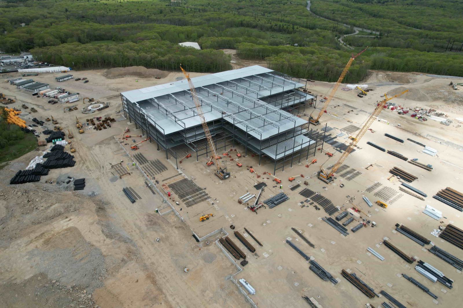
An aerial survey that covers the entire site on paper may have gaps in practice. Shadows from tall buildings, steep terrain, or reflective surfaces such as water or solar panels can create areas where the point cloud has no data or where the orthophoto is blurred. Check the coverage map that accompanies the deliverables. If the provider did not supply one, you can generate a quick density map from the point cloud. Areas with fewer than a minimum number of points per square meter will produce noisy surfaces and unreliable contours.
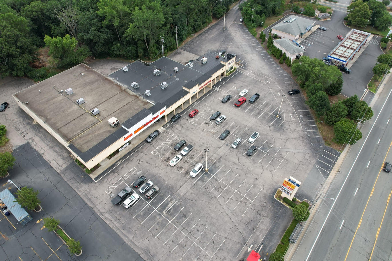
For linear projects such as pipelines or roads, verify that the data extends far enough beyond the corridor to allow for design buffers and temporary works. A five-meter buffer on each side of a pipeline may sound generous, but if the survey stops at the edge of the easement, the design team will have no information about adjacent ground conditions that affect access routes or spoil placement.
Time stamps and versioning
Aerial data is a snapshot of a moment in time. Construction sites change fast, and a deliverable that is two weeks old may already be out of date for certain applications. Check the acquisition date and the processing date. If the site has had earthworks, demolition or new structures between those dates, the deliverables may not reflect current conditions. The project team should also confirm that the processing metadata includes the software version and the processing parameters used. When a provider updates their workflow, the same raw data can produce slightly different results. If the deliverables will be used as a baseline for future surveys, knowing the exact processing version helps maintain consistency over time.
Versioning matters just as much. If the provider sends a corrected set of deliverables after finding an error, the old files should be clearly marked as superseded. A project folder that contains "ortho_final.tif" and "ortho_final_v2.tif" invites confusion. Agree on a versioning convention before the project starts, and check that the provider follows it.
Inspection and annotation data
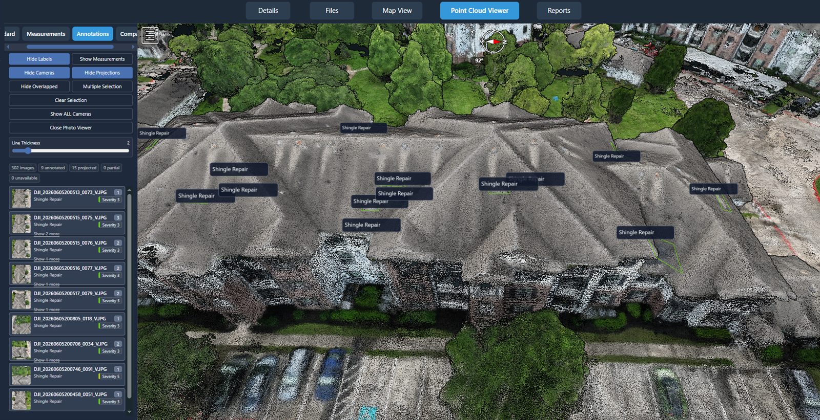
For infrastructure inspections, the deliverables often include annotations for defects, measurements or observations. Check that each annotation is tied to a specific geographic coordinate and that the reference point is clear. A note that says "crack near the south abutment" is less useful than one that includes a latitude-longitude pair and a photograph. The team should also verify that the annotation layer uses the same coordinate system as the base map; otherwise the pin will appear in the wrong location when the layers are combined.
If the annotations include measurements such as crack width or pipe diameter, confirm the unit of measure and the precision tolerance. A measurement reported to three decimal places when the underlying point cloud has a resolution of two centimeters is misleading. The project team should have a threshold for acceptable measurement accuracy and reject annotations that exceed it.
Metadata and reporting
A complete deliverable package includes a metadata report that describes the flight parameters, camera calibration, processing workflow and accuracy statistics. Without this report, the data cannot be properly evaluated for a new purpose later. For example, an orthophoto collected with a 20-megapixel camera at 120 meters above ground may look sharp but will have a different ground sample distance than one collected at 80 meters. The metadata allows future users to decide whether the data is suitable for their application without having to re-process the raw files.
National Drone Services provides a platform that standardises many of these checks into a single workflow. When you use a drone mapping platform such as the one offered by nationaldroneservices.net, the system can automatically validate coordinate systems, check file formats against your project template, and flag incomplete coverage areas before the data reaches the team. This reduces the manual verification effort and catches mismatches early.
Even with automated checks, the project team should run a manual sanity check on every new deliverable set. Open the orthophoto at full resolution and pan across the site. Look for stitching errors, colour seams or areas where the image is soft. Load the point cloud and verify that the ground surface looks continuous under buildings and trees. These simple visual checks take a few minutes and often reveal issues that automated validation misses.
National Drone Services also offers nationwide turnkey capture, which means the same platform can be used to request new surveys if the deliverables do not meet the project's standards. The team does not need to find a different provider and renegotiate terms; the existing workflow extends to the capture phase. This integration between capture and processing is one reason why a drone mapping platform that covers both steps tends to produce more consistent deliverables.
Finally, agree on a handover checklist with the provider before the flight. Specify the coordinate system, the required file formats, the accuracy standard, the coverage buffer and the metadata requirements. Put it in writing. A provider who receives a clear specification at the start is far more likely to deliver files that pass the team's checks on the first attempt. The time spent drafting that specification is tiny compared to the time lost correcting a misaligned point cloud or re-flying a site because the coverage was incomplete.
Aerial mapping deliverables are the foundation of many project decisions. Checking them carefully before distributing them to the wider team prevents errors from propagating into designs, reports and construction plans. With a systematic checklist and a platform that supports validation, the project team can move from data receipt to confident use in hours, not days.
National Drone Services on social media
 Facebook